Chaguanas suburban residential areas, can be classified into areas of low class, middle class and high class. Low-class residential areas include ones such as Enterprise, which can be seen pictured below (Photograph 1), and formerly, Edinburgh 500. According to Hoyt's model of an industrial city, low income areas were built along or near to railroad lines. This model was based in a time where railways were a more popular form of transport, in the early 20th century. This can be noted upon investigation of a map of the Trinidad railway lines from that time period, which infers that these areas were built accordingly. While there are no longer any operational railroads in Trinidad, particularly in Chaguanas, there are still remains areas of low income housing in close proximity to major accessibility routes (i.e. Southern Main Road). However, there has been some features of urban development taking place, for example new housing complexes for residents (also pictured below).
 |
| PHOTOGRAPH 1, taken with Canon EOS REBEL T3i/EOS 600D. (Date taken: 24/02/15) |
Middle-class residential areas found in Chaguanas include Orchard Gardens (Photograph 2), Cunupia and Edinburgh Gardens (not the same as Edinburgh 500). These areas would be similar in some ways to the high-class areas, in that it would be attractive to people interested in living in these regions. The standard of living would be more affordable to people who belong to a more moderate income bracket, with the supplemental benefits of easy accessibility to both the CBD and major transportation routes.
 |
| PHOTOGRAPH 2, taken by Kristen Goseine with Canon EOS REBEL T3i/EOS 600D. (Date taken: 24/02/15) |
The major high-class residential area in Chaguanas is Lange Park (Photograph 3). This area conforms to the expectations of a high class area as presented by Hoyt, where it is branched directly from the CBD as a small wedge. This may be so, as there is minimal industrial/manufacturing activity taking place in this area. Therefore, factors such as noise and pollution, that would usually influence high classed people into living further away, would not be in play here.
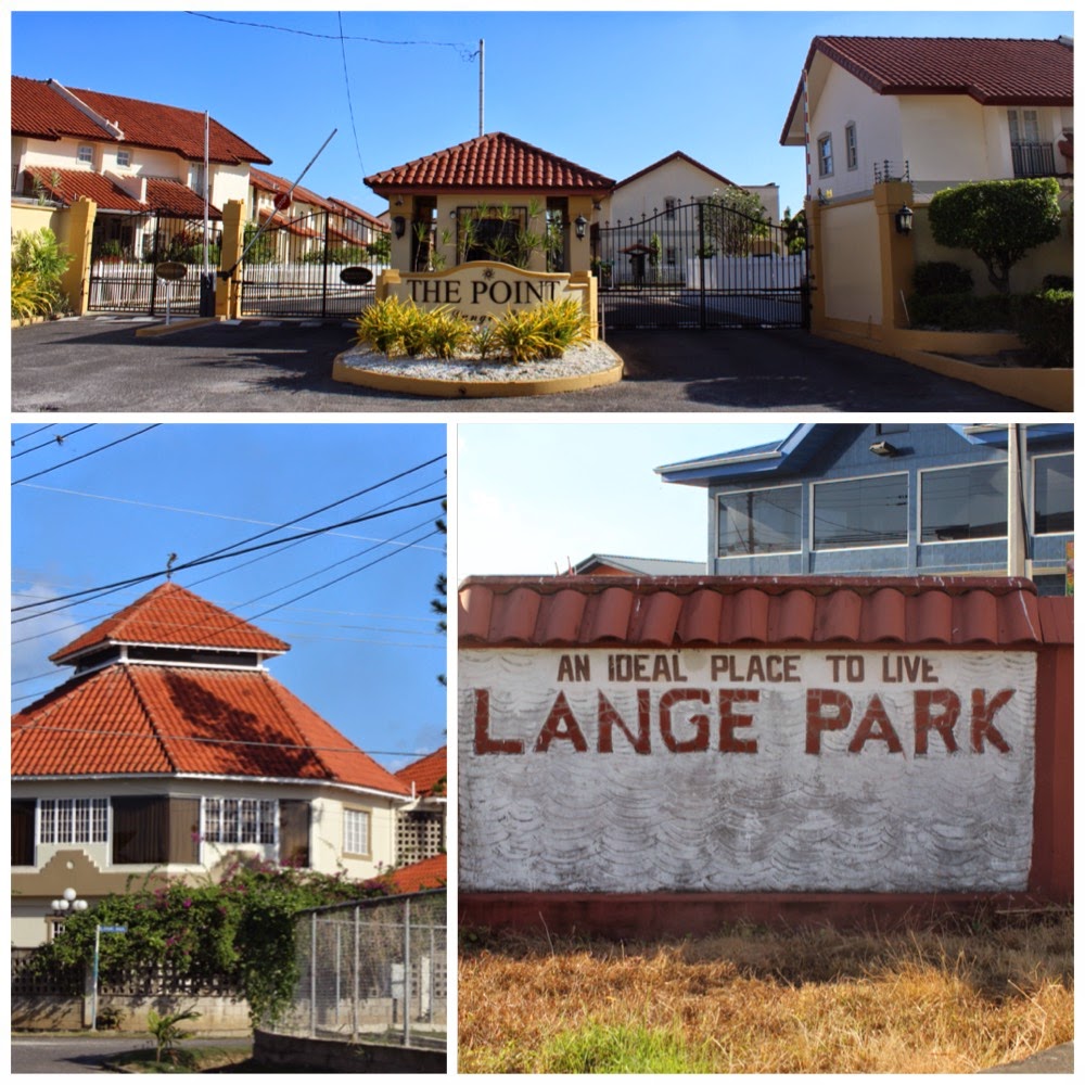 |
| PHOTOGRAPH 3, taken by Kristen Goseine with Canon EOS REBEL T3i/EOS 600D. (Date taken: 24/02/15) |
The middle and high class residential areas described here are much like the one described in the episode of the popular '90s television show, Friends, in the episode "The one where Chandler gets caught."
References:
- "Models from Burgess and Hoyt." A-level Geography Urban Profiles Revision -. Web. 25 Feb. 2015. <http://www.s-cool.co.uk/a-level/geography/urban-profiles/revise-it/models-from-burgess-and-hoyt>.
- "Railroad Map of Trinidad." WDL RSS. Web. 25 Feb. 2015. <http://www.wdl.org/en/item/11332/>.
- "The One Where Chandler Gets Caught." IMDb. IMDb.com. Web. 25 Feb. 2015. <http://www.imdb.com/title/tt0583445/>.
- "The Structure of Cities - Boundless Open Textbook." Boundless. Web. 25 Feb. 2015. <https://www.boundless.com/sociology/textbooks/boundless-sociology-textbook/population-and-urbanization-17/urbanization-and-the-development-of-cities-123/the-structure-of-cities-694-10482/>.
